What is CoastSnap?
CoastSnap is a global “Citizen Science” project that aims to engage citizens to participate in scientific research on the accretion and erosion of beaches. For this purpose, the project provides specially designed holders at fixed “CoastSnap locations” where passers-by can place their smartphones to take a picture of the beach. These photos are then sent in via mail or shared on social media and collected in a big data set, so researchers can analyze and map the growth or decline of the beach. Along the Belgian coastline you can find stations located in Wenduine, Oostende Oosterover, Raversijde, Nieuwpoort (coming soon) and Koksijde. The beaches on these locations are subject to many factors that affect accretion, and with your help CoastSnap contributes to a better understanding of how exactly the beaches respond to all those influences. Get to know the Belgian CoastSnap sites and other associated projects below!


How to use CoastSnap?

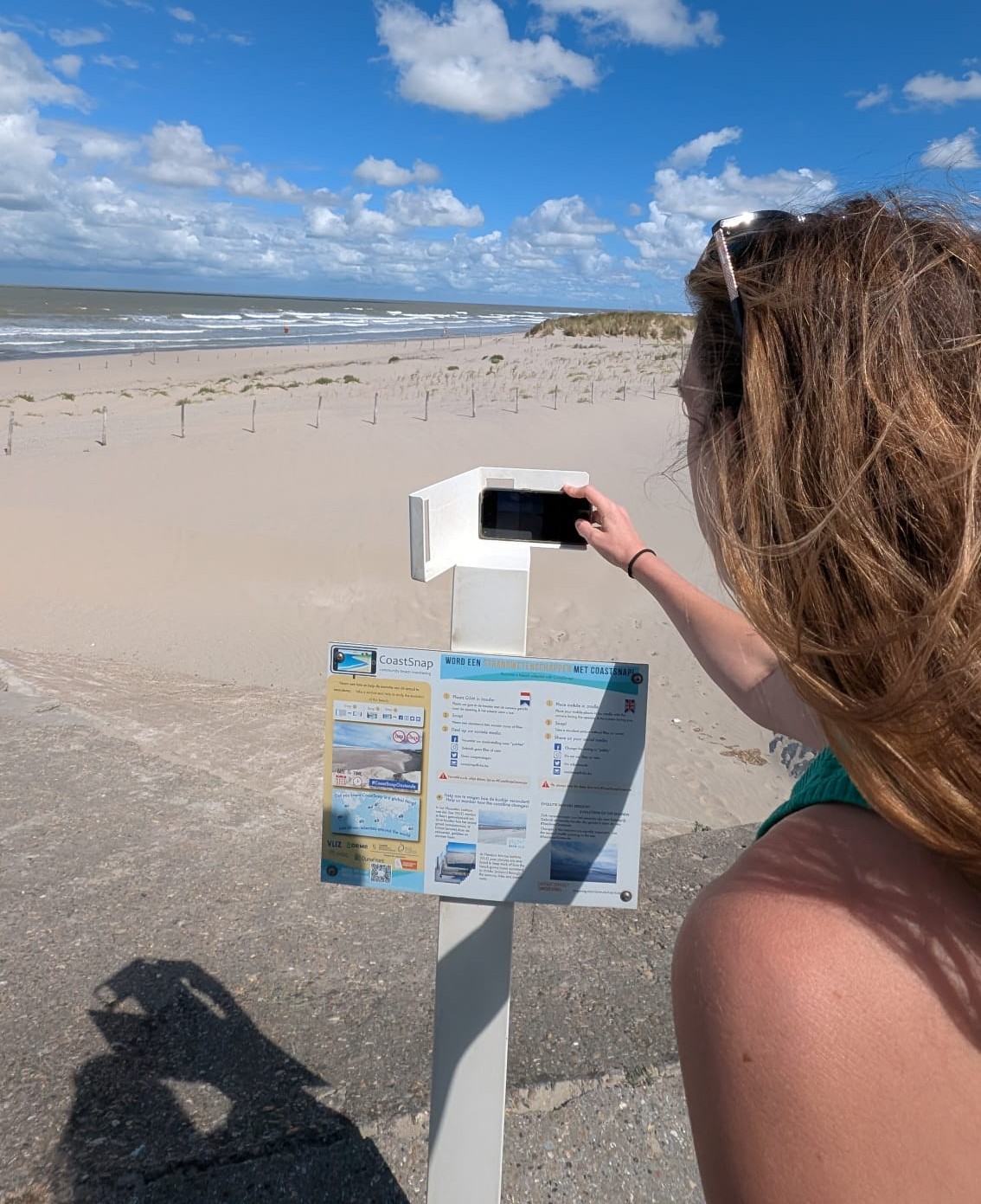
 Holder + Mobile
Place your mobile in the holder, against the leftmost edge. Make sure your mobile's camera can see through the gap, and the screen faces towards you. Placing the device correcty is extremely important, otherwise your picture will not be usable in the researcher's analysis.

 Snap!
Snap!
When the mobile is positioned correctly, take a picture of the beach. Do not use any zoom or filter functionality!

 Share your picture with us through social media!
Use the appropriate hashtag (e.g. #CoastSnapOostende), or send an email to coastsnap@vliz.be. This way, we can add your picture to the set that is going to be analyzed in the future. Please make sure that you mention the date and time on which the picture was taken!
Belgian stations
Wondering where the Belgian CoastSnap stations are located? You will find them in Wenduine, Oostende Oosterover, Raversijde, Nieuwpoort (coming soon!) and Koksijde. Also on this map are the demonstrator sites of the DuneFront project (learn more about it underneath the Raversijde - Living Lab site)
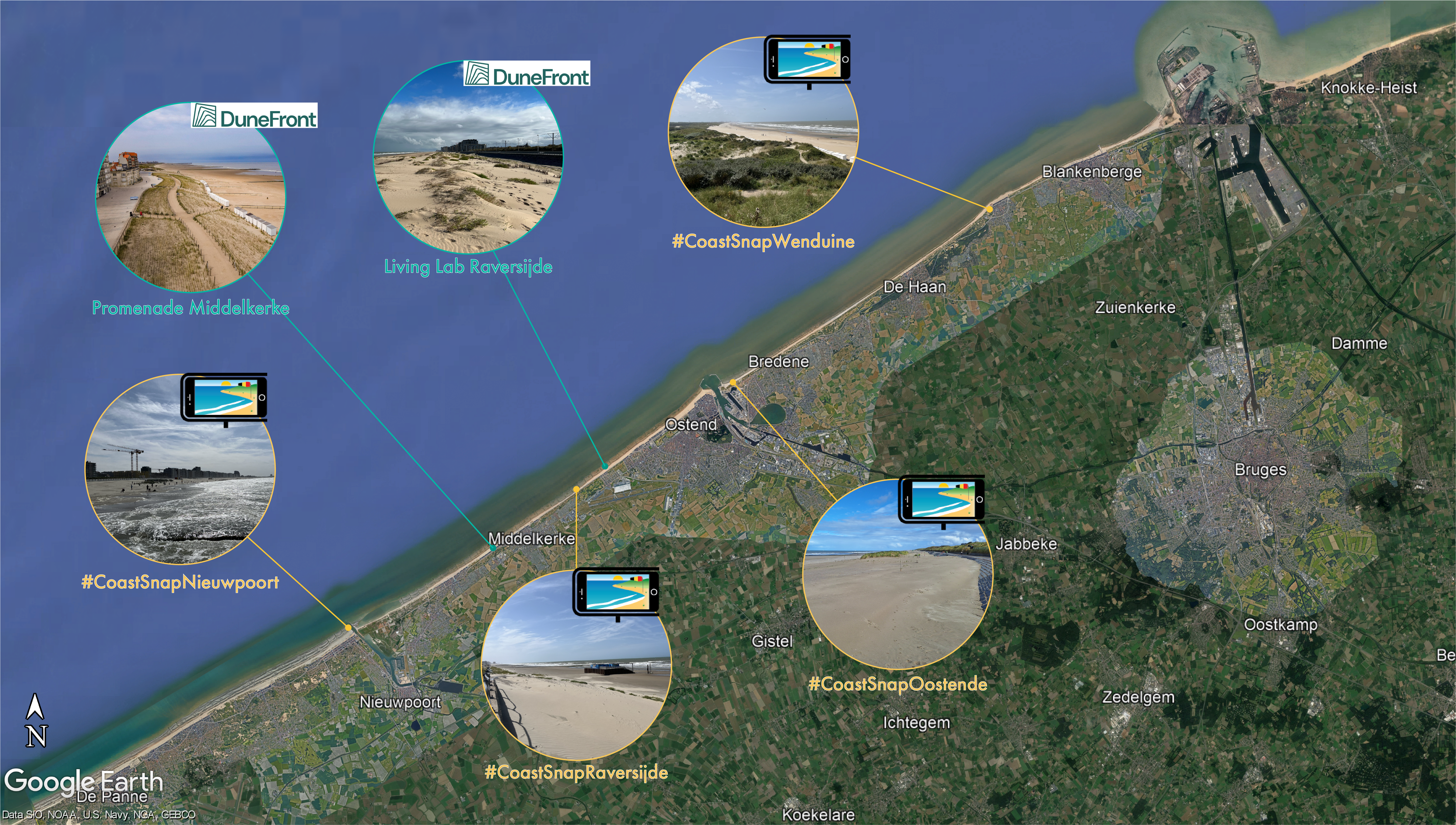
Source image: "Google Earth. The Belgian Coast. Retrieved 10 October 2024, from https://earth.google.com.”
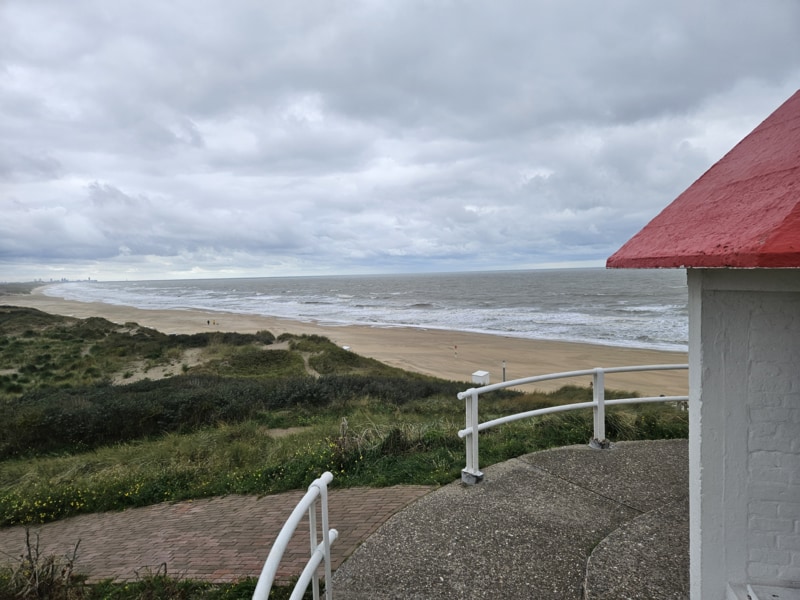
Wenduine
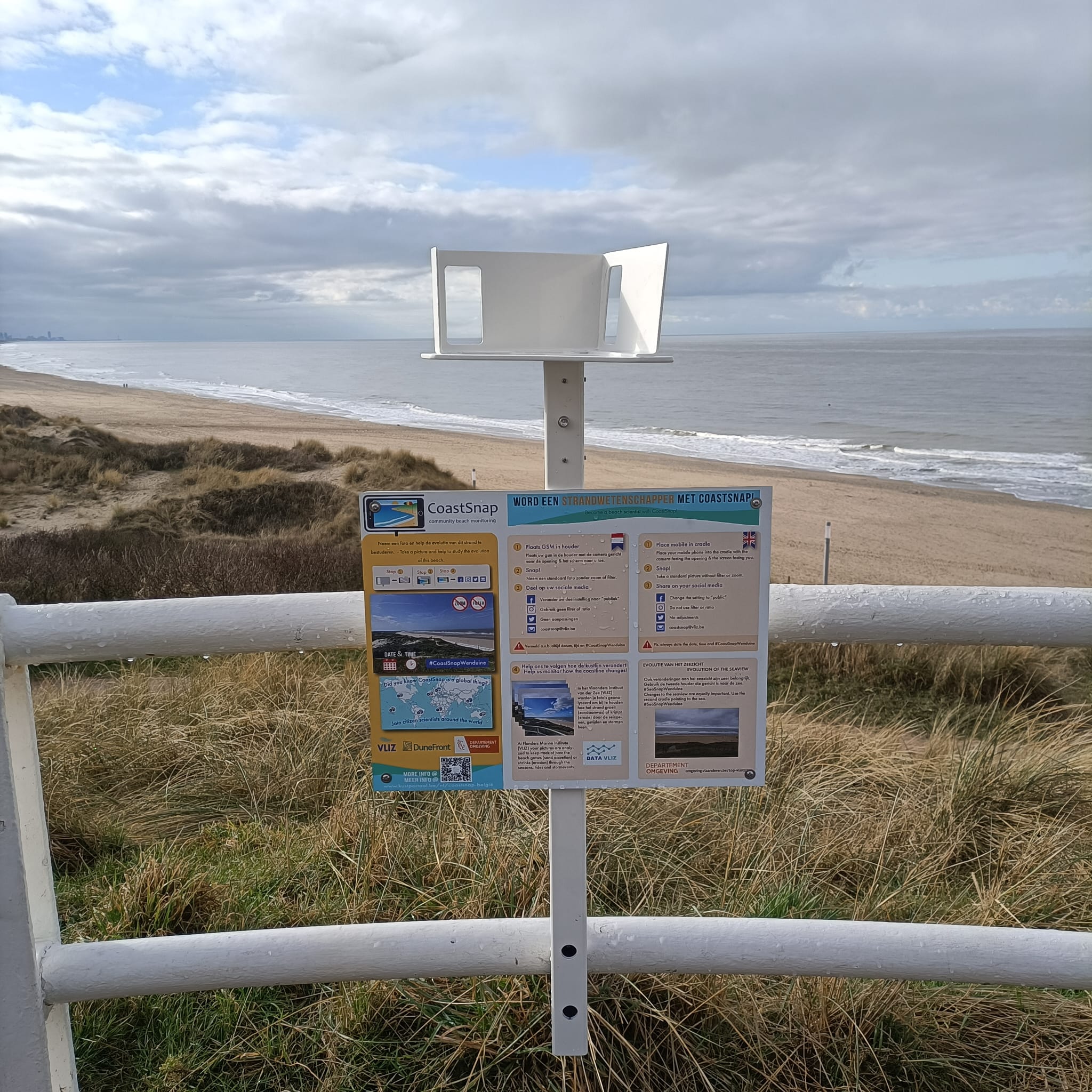
Starting off with our easternmost site, you can find a CoastSnap Station on the Spioenkop in Wenduine - Belgiums second highest coastal dune! With an altitude of 31 meters this is a perfect vantage point to snap a picture of the rolling coastline below. Used as an observational post during the first world war, it is now a place for locals and tourists to enjoy.
 As part of a collaboration between VLIZ and the Departement Omgeving you can also find a second holder turned toward the sea at this station. Pictures taken through this holder focus on the seascape, rather than the shoreline. They are part of the project T.OP Kustzone which aims to document and visualize the changing use of the North Sea. Share these pictures under #SeaSnapWenduine to help document new infrastructure and projects appearing on the horizon!
Learn more about the T.OP Kustzone Project: T.OP Kustzone | Departement Omgeving - Vlaamse overheid
Oostende Oosteroever
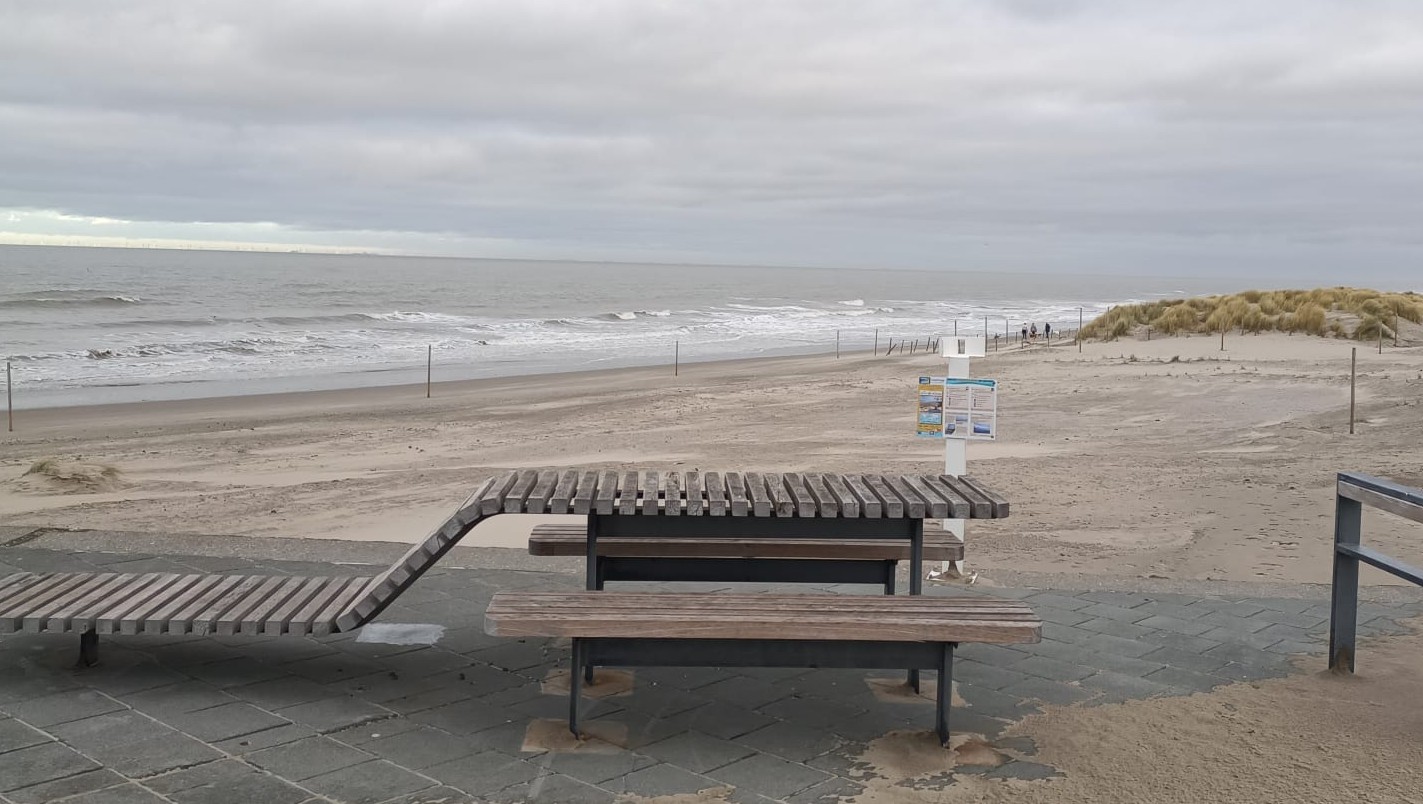
Located at the Spinoladijk about 300 m from the entry to the beach, this is the very first Belgian CoastSnap station and invites you to snap a picture and take a break on the nearby bench. Looking out you will notice the presence of a dike over the entire length of the beach. Oosteroever is a combination of a dune, port, industrial and residential area. Strongly influenced by the nearby harbor walls, this beach section, as many others along the Belgian coast, has been artificially filled to compensate eroding effects.
The poles that you can see on the beach are part of a project executed by KU Leuven and initiated in July 2020. By demarcating zones for spontaneous dune growth and planting marram grass, the project’s goal is to foster natural sea walling. For the analysts at the VLIZ marine data center, however, these poles are actually also very helpful during the processing of pictures. On a beach with so little “fixed” points (structures that do not move), they can be utilized as recognition points!
Find out more about Dune restoration project:
https://www.agentschapmdk.be/nl/projecten/grote-puzzel-van-helmgras-om-zandvangende-capaciteit-te-meten
As part of a collaboration between VLIZ and the Departement Omgeving you can also find a second holder turned toward the sea at this station. Pictures taken through this holder focus on the seascape, rather than the shoreline. They are part of the project T.OP Kustzone which aims to document and visualize the changing use of the North Sea. Share these pictures under #SeaSnapOostende to help document new infrastructure and projects appearing on the horizon!
Learn more about the T.OP Kustzone Project: T.OP Kustzone | Departement Omgeving - Vlaamse overheid
Raversijde
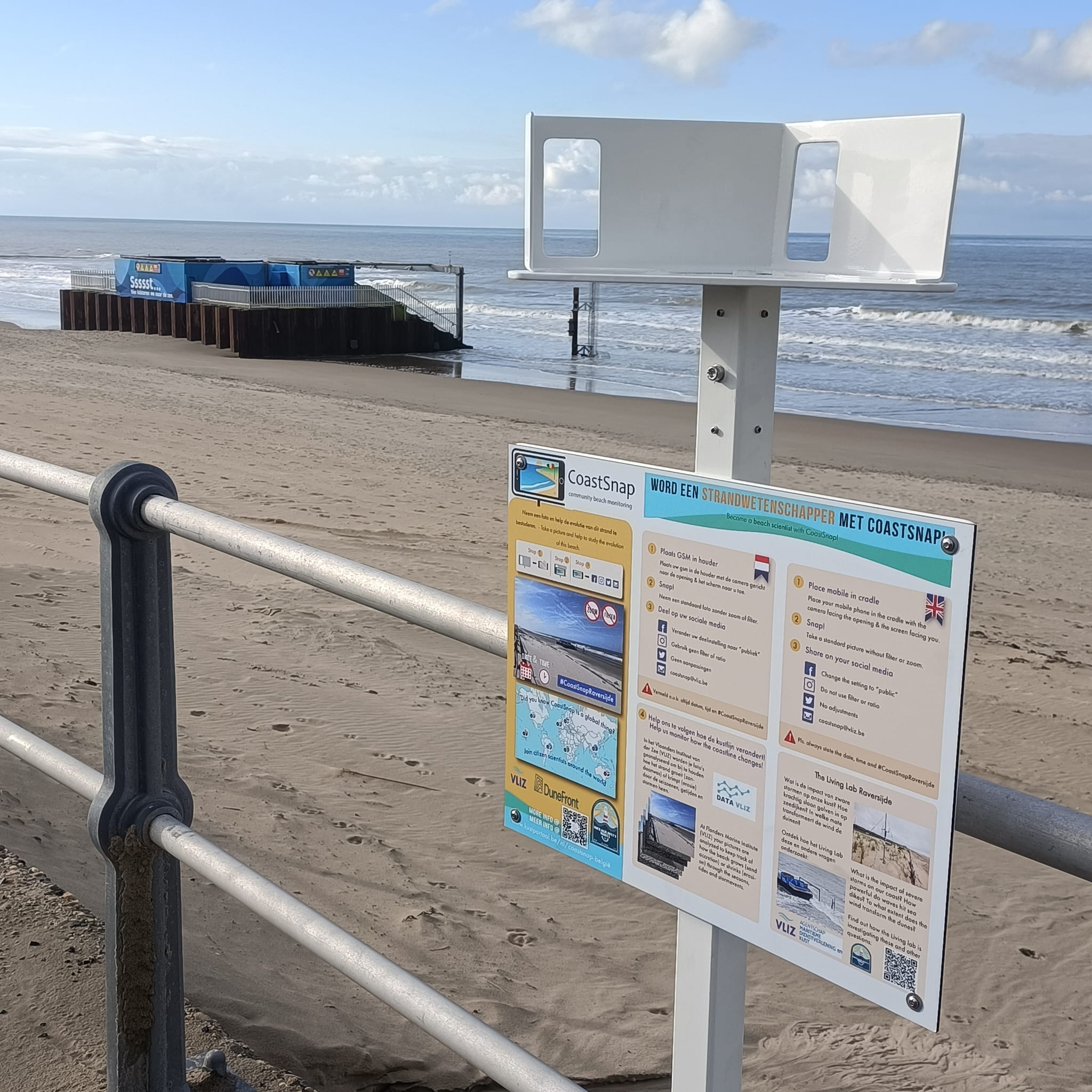
Attached to the railing of the promenade between tram stop Raversijde Middenlaan and Raversijde Provinciedomein, this might just be the most interesting CoastSnap station! It shares this site with various other science projects. Walking the beach or riding the tram between Oostende and Middelkerke you will likely first spot a curious concrete structure on the beach: This is a research dike that forms part of the “Living Lab Raversijde”. Here the Coastal Department of the Agency for Maritime and Coastal Services (MDK), the Flanders Marine Institute (VLIZ) and Flanders Hydraulics Research (Department of MOW) are investigating questions such as What is the impact of severe storms on our coast? How powerful do waves hit sea dikes? To what extent does the wind transform the dunes? To answer the latter, the living lab also includes a so-called dune-for-dike - a test setup with dunes over a distance of 750 meters in front of the existing sea dike. Hypersensitive equipment takes measurements and aeolian sand transport dynamics are manipulated by planting marram grass in various configurations and concentrations. Serving as a pilot for the evaluation of hybrid Nature-based solutions Raversijde lends itself as a demonstrator site to the innovative project “DuneFront”.
DuneFront aims to enhance coastal protection and safety by optimizing solutions that make use of a combination of natural elements (dunes) and man-made hard structures (seawalls). These so-called hybrid Dune-by-Dike Nature-based solutions (DD-hybrid NbS) will constitute the new generation of sustainable, inclusive, and aesthetic coastal protection.
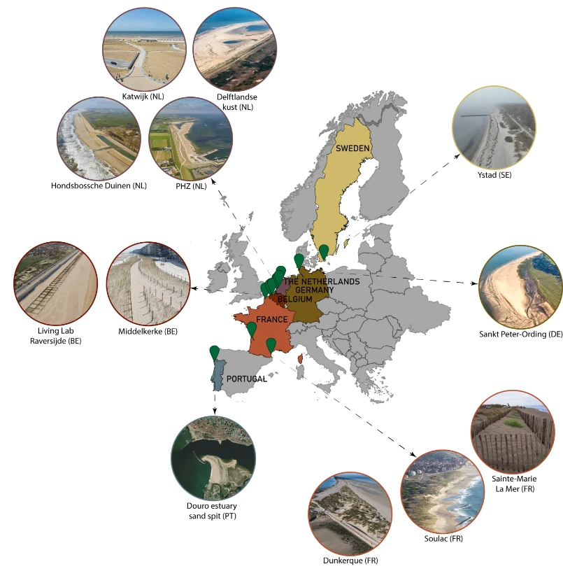
Within the DuneFront project, data is collected and evaluated from 12 different ‘Demonstrator sites’ spread over six different countries. Each of the demonstrators represents a hybrid nature-based solution (NbS) where dunes and hard infrastructure (dikes, groynes) are combined under the primary objective of coastal protection and biodiversity restoration. Alongside recreation can be facilitated and aeolian sand nuisance alleviated. Moving down the Belgian coast and before heading to our Nieuwport CoastSnap station, make sure to visit a second DuneFront demonstrator site at Middlekerke Grasdijk! Learn more about hybrid Dune-by-Dike Nature-based solutions and the project here: https://www.dunefront.eu/ or have a look at the following videos created by Sien Deroo, student in the Master of Science in Biology at Ghent University! Under the supervision of Dries Bonte and Charlotte Taelman, Sien developed short films with the purpose of reaching out to the coastal residents of Ostend. By informing them about the purpose and benefits of Dune-Dike hybrids, we create social support to further integrate dunes in our coastal infrastructure. The videos are part of a project within the Excellence Programme in Sciences at Ghent University. This project centres on the role of Marram grass in dune formation, as well as on the impact of storms on the dunes.
At Raversijde also the backdunes (crossing the rails) are worth a visit as they form an open air museum that showcases a very well preserved part of the Atlantik Wall - the extensive defense line the Germans aimed to build but never completed during the second world war.
Learn more: https://www.visitoostende.be/en/atlantikwall-raversyde
Nieuwpoort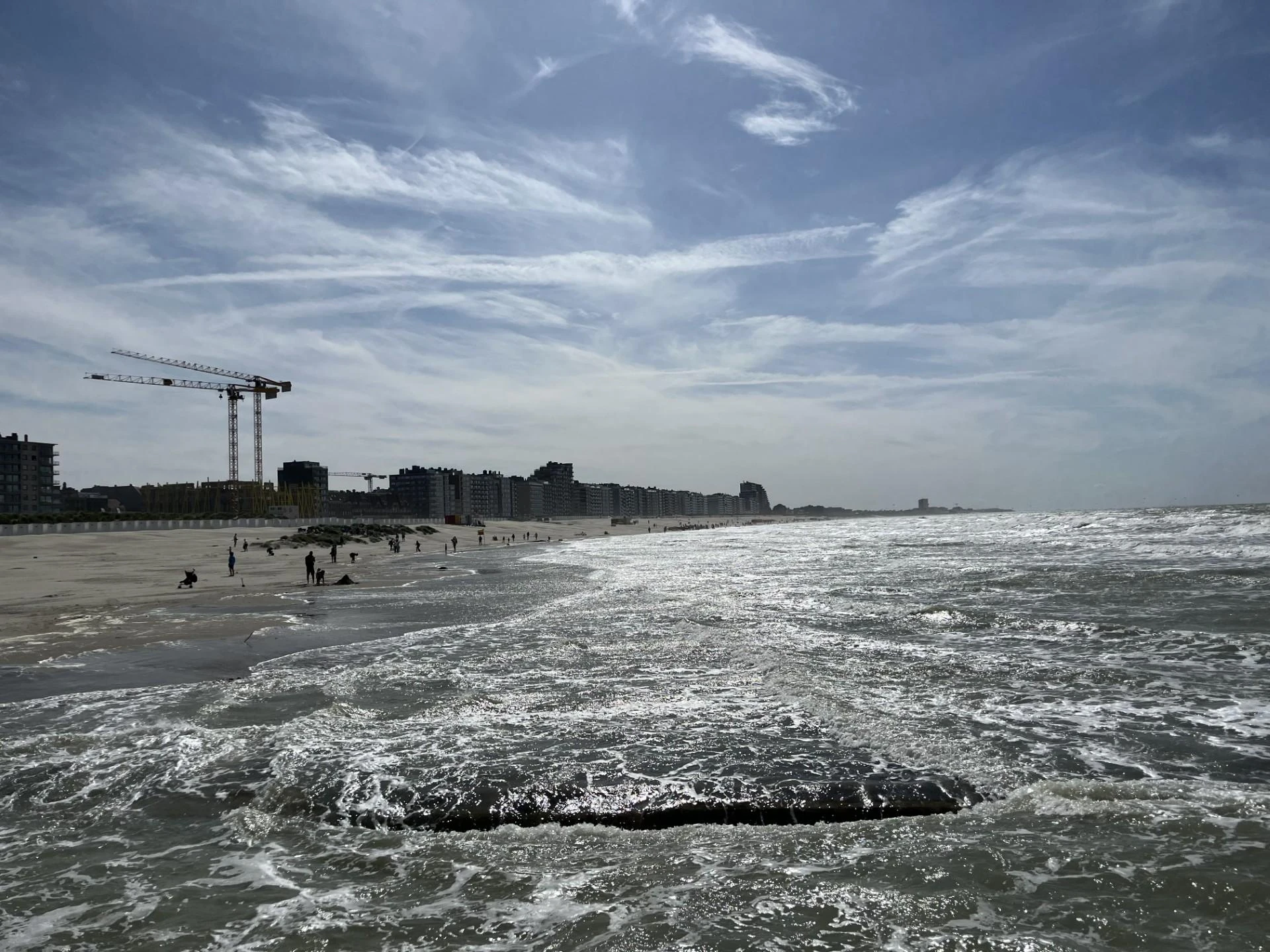
Coming soon!
For this CoastSnap station you will have to walk out into the ocean on the western Nieuwpoort pier, where you can snap a picture of the coastline and capture another of the horizon for the T.OP Kustzone Art project mentioned above.
Koksijde
This CoastSnap station is located at surfclub Windekind, near Belgium’s biggest water sports zone, and has a wide beach. It’s also quite close to the nature reserve ‘Ter Yde’, which is worth a visit.
International Coastsnap stations
CoastSnap is a global project, conceived and founded by Dr Mitchell Harley of the University of New South Wales in Sydney, Australia. The first CoastSnap station was installed there in 2017. Since then, in addition to Australia, several other countries have joined the CoastSnap story. There are currently about 650 stations in 37 countries active all over the world, from Madagascar to Brazil to Spain, England and the United States. Currently an international platform is being developed on which all these stations can be gathered, and the representatives of the different stations try to meet annually to exchange ideas and experiences.
The map below indicates the location of some international CoastSnap stations. By clicking on an icon, a popup shows more information about the specific station:
More info about the project
Help monitor the beaches
Research on the growth or decline of beaches is nothing new, as this dynamic can have important ecological, socio-economic (e.g. beach tourism) and coastal security (flooding, erosion) consequences. While there are several methodologies that use cameras and other remote sensing technologies, these setups not only require significant funding, but also ongoing maintenance and technical knowledge. CoastSnap wants to eliminate this by using the local community and tourists to capture the same images. The only installation necessary is a holder for smartphones that ensures that all pictures are taken from the same angle and position.
The participation of passers-by at the stations is of great importance. The more people take a photo and share it with the project, the larger the data set that will be used, and the better researchers can map the changes on the beach.
Belgian beaches change constantly
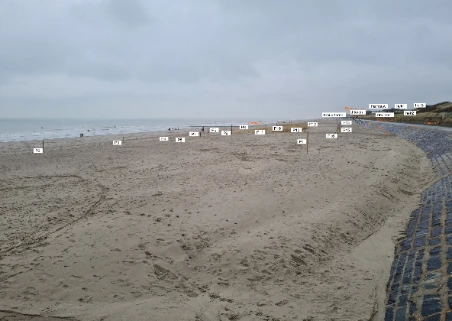
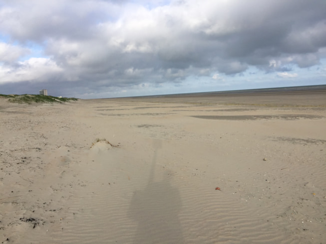
Anyone who walks along the beaches has certainly noticed: our beaches are constantly evolving under the influence of the seasons, tides, currents and human interventions. They are built up during the summer and decrease again in the winter, in the latter case often by storms that cause the so-called “beach cliffs”. On top of this, artificial constructions have an additional influence on them. In order to be able to map how all this affects our beaches, or how we can make them more resistant to it, scientists would like to study their evolution. A series of images showing exactly the same part of the beach can be used to calculate, for example, the location of the low tide line throughout a whole year and match or contrast it against seasonal variations or storm events.